Ontario: stops on the Lake Superior Circle Tour
35 stops in Ontario, in clockwise route order from Thunder Bay to Agawa Canyon Tour Train.
Ontario — Superior Country (Thunder Bay to Pukaskwa / Marathon)
Thunder Bay
Thunder Bay is the most populous city in Northwestern Ontario and sits on the north shore of Lake Superior.
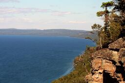
Fort William Historical Park
Fort William Historical Park is a living history site at 1350 King Road that recreates Fort William, the inland headquarters of the North West Company, as it was in the fur trade year 1815.
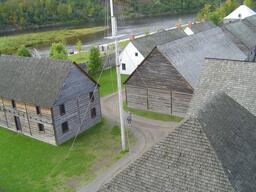
Kakabeka Falls Provincial Park
Kakabeka Falls is a 40-metre waterfall, the second highest in Ontario, viewed from a boardwalk that wraps around the top of the falls.
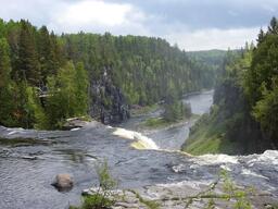
Terry Fox Monument and Visitor Centre
The Terry Fox Monument is a 9-foot bronze statue on a 45-ton granite base beside Highway 11/17, 1 kilometre east of Hodder Avenue, with a view of Lake Superior and the Sleeping Giant.
Sleeping Giant Provincial Park
Sleeping Giant Provincial Park on the Sibley Peninsula has over 100 km of hiking trails, including the Top of the Giant Trail and the Thunder Bay Lookout, with views of Lake Superior.
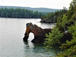
Silver Islet
Silver Islet is a small historic community at the southern tip of the Sibley Peninsula, past Sleeping Giant Provincial Park, whose history began with the discovery of a rich silver vein in 1868.
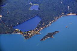
Ouimet Canyon Provincial Park
Ouimet Canyon is a day-use park where a trail and boardwalk connect two lookout platforms over a 150-metre-wide gorge with cliffs that drop 100 metres to the canyon floor.
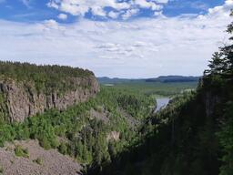
Red Rock
Red Rock is a small town on the northern shore of Lake Superior with a marina and Marina Interpretive Centre, and a 10 km Nipigon River Recreation Trail that runs to Nipigon.
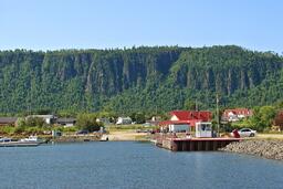
Nipigon
Nipigon is a township on the north shore of Lake Superior where Highway 11/17 crosses the Nipigon River on a cable-stayed bridge, next to the 40-foot Bridgeview Lookout Tower.
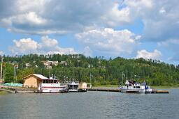
Rossport
Rossport is a community of approximately 75 residents on the north shore of Lake Superior, once a Canadian Pacific Railway hub, whose offshore archipelago is popular among paddlers.
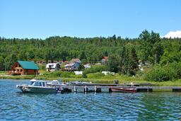
Rainbow Falls Provincial Park
Rainbow Falls Provincial Park has a waterfall that drops over rock ledges on its way to Lake Superior and three trails with views of Lake Superior and Whitesand Lake.
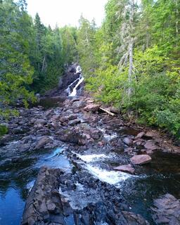
Schreiber
Schreiber is a township just off the Trans-Canada Highway that grew as a railway divisional point and has a Discovery Centre and Railway Museum.
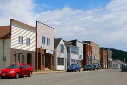
Schreiber Beach
Schreiber Beach is a pebble beach on the Lake Superior shore close to the town of Schreiber, with a beach pavilion reached by an accessible ramp, picnic tables and parking nearby.
Aguasabon Falls and Gorge
Aguasabon Falls is a 100-foot (30.5-metre) waterfall that drops into the Aguasabon Gorge, reached by a wheelchair-friendly boardwalk and serving as an entry point to the Casque Isles Trail.
Terrace Bay
Terrace Bay is a town on Highway 17 overlooking Lake Superior, with a sandy Lake Superior beach that has a boardwalk, picnic pavilion and accessible kayak launch.
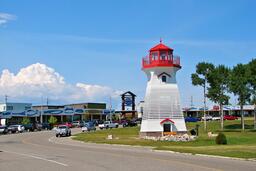
Terrace Bay Lighthouse
The Terrace Bay Lighthouse is a 50-foot replica of the Slate Islands lighthouse, built in 2011 beside Highway 17, that visitors can climb for a view over Terrace Bay Beach and Lake Superior.
Neys Provincial Park
Neys Provincial Park has a sand beach on Lake Superior's north shore and a Visitor Centre with a model of the former prisoner-of-war Camp 100, whose remains are in the park.
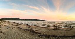
Marathon
Marathon is a town on the shore of Lake Superior that began in 1883 as a Canadian Pacific Railway construction camp and is known for Pebble Beach, where wave-polished rocks line the shore for over two kilometres.
Pukaskwa National Park
Pukaskwa National Park spans over 1,878 square kilometres of Lake Superior's northern coast and is reached from Highway 17 by driving 13 km south on Highway 627, just east of Marathon, to the Hattie Cove area.


Ontario — Algoma (White River to Sault Ste. Marie)
White River
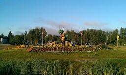
Highway 17 town whose Winnie the Pooh Park and statue mark it as the place where Lieutenant Harry Colebourn bought the black bear cub Winnie in 1914.
Wawa
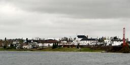
Town where the last link of the Lake Superior section of the Trans-Canada Highway was opened on September 17, 1960, known for its Wawa Goose statue at the Visitors Information Centre.
Scenic Magpie High Falls
Waterfall on a dirt road off Highway 17 south of Wawa with a viewing platform, parking, picnic shelter and washrooms.
Sandy Beach
Lake Superior sand beach near Wawa reached by a maintained dirt road, with a commemorative Group of Seven display.
Lake Superior Provincial Park
Natural Environment class provincial park of 160,810 hectares, established in 1944, with campgrounds at Agawa Bay and Rabbit Blanket Lake along Highway 17.
Old Woman Bay
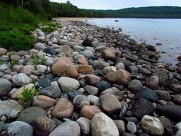
Day use area and beach in Lake Superior Provincial Park that is also the access point for the 5 km Nokomis Trail loop.
Katherine Cove
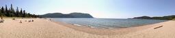
Day use area and beach in Lake Superior Provincial Park that also gives access to the Coastal Trail.
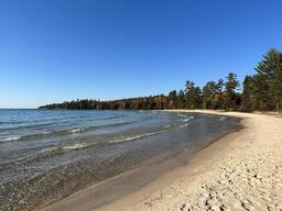
Sand River (Pinguisibi Trail)
The Pinguisibi Trail at Highway 17 km 1090.6 in Lake Superior Provincial Park is an easy 6 km return walk along the Sand River, whose falls the Municipality of Wawa lists as Sand River Falls.
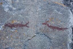
Agawa Rock Pictographs
Sacred lakeside pictograph site in Lake Superior Provincial Park, reached by a trail and viewed from a rock ledge on Lake Superior.
Agawa Bay Visitor Centre and Campground
Lake Superior Provincial Park campground and beach at Highway 17 km 1105.5, where the Visitor Centre is the focal point for the park's interpretive programs.
Pancake Bay Provincial Park
Recreational class provincial park with more than 3 km of sand beach and a Lake Superior view from the Lookout Trail loop of the Edmund Fitzgerald hiking trail.
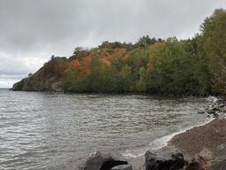
Batchawana Bay Provincial Park
Recreational class provincial park on Highway 17 with a Lake Superior beach and picnic site.
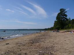
Chippewa Falls
Roadside waterfall on Highway 17 where an Ontario Motor League plaque marks a midpoint of the Trans-Canada Highway.
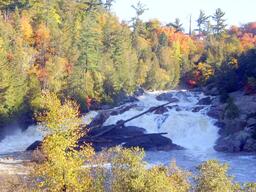
Sault Ste. Marie
City on the St. Marys River, where Lake Superior drains into Lake Huron, joined to Sault Ste. Marie, Michigan by the International Bridge.
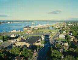
Sault Ste. Marie Canal National Historic Site
Parks Canada site at 1 Canal Drive preserving the canal built in 1895, which had the world's longest lock and the first to operate using electricity.
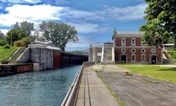
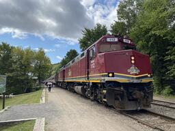
Agawa Canyon Tour Train
One-day, 114-mile rail excursion from the depot at 87 Huron Street in Sault Ste. Marie to Agawa Canyon Park, which is accessible only by rail and has trails, a lookout and two waterfalls.